Climate change is increasing the risk of severe droughts in the UK, and demand for water keeps increasing too. Thames Water’s proposed South East Strategic Reservoir Option (SESRO) is one significant response.
Thames Water forecasts that it will need one billion litres more water every day for its customers by 2075 to accommodate climate change and population growth, and to protect the environment by reducing the amount of water taken from rivers and chalk streams.
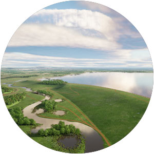
To protect public water supplies during periods of drought and meet increased demand for water, Thames Water proposes to develop a new reservoir* to the south west of Abingdon in the Vale of the White Horse district of Oxfordshire (together with Affinity Water and Southern Water).
The new reservoir would store water from the River Thames in winter and release the water back into the river when river levels drop or demand for water increases.
Reservoir construction is proposed to begin in 2029, with operation starting in 2040.
The South East Strategic Reservoir Option (SESRO) is classified a Nationally Significant Infrastructure Project.
The location
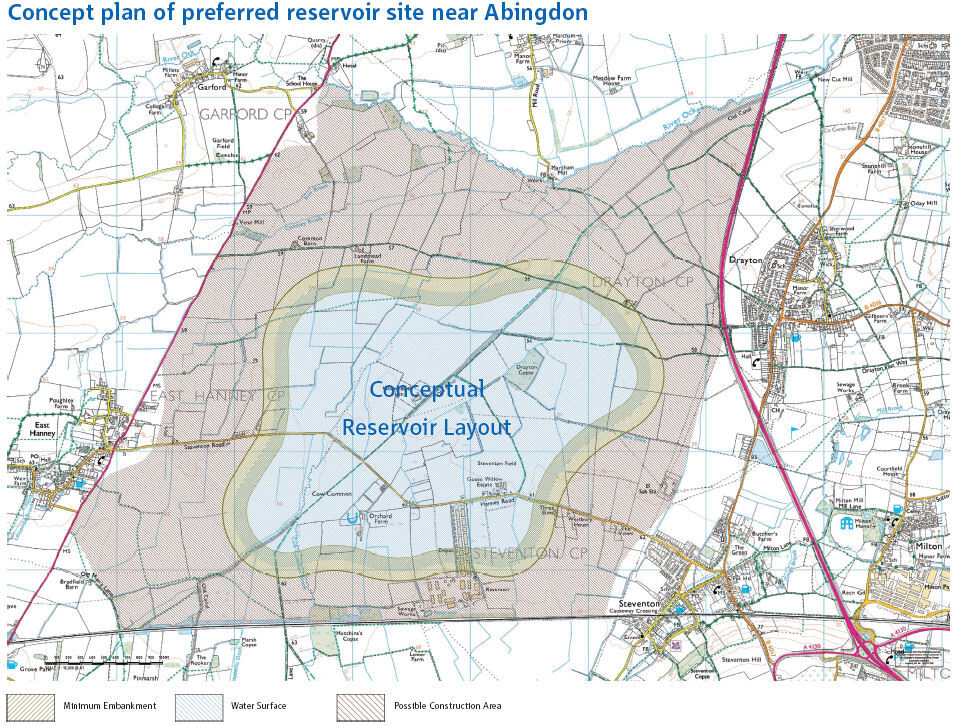
The reservoir site will be bounded by the:
- A34 to the east
- Great Western Main Line railway (London to Bristol) to the south
- A338 to the west
- River Ock to the north.
Site selection criteria included:
- closeness to the River Thames (connectivity to transfer water)
- reasonably flat topography
- adjacence to a railway line and major road links
- suitable bedrock geology (primary impermeable strata).
The numbers
The reservoir surface-water area will be 6.7km2, with a storage capacity of 150 million cubic metres, providing a potential supply of up to 271 million litres of water per day.
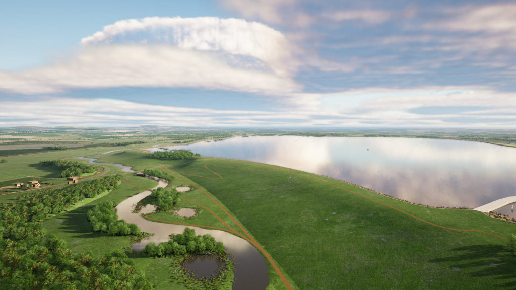
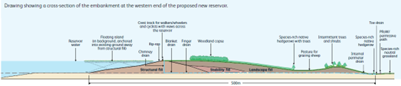
An embankment 10km long and 15 to 25m high will create a watertight perimeter around the reservoir. The embankment will be built using local bedrock clay formations (Kimmeridge Clay and Gault Clay) excavated from the centre of the site, creating the reservoir basin.
An inner-face layer of rip-rap (large, angular blocks) will protect against erosion.
Internal drainage (chimney, blanket, finger and toe drain) will channel water from the embankment into new diverted watercourses.
Flood risk
The SESRO encroaches on existing floodplain area, and has the potential to make the local flood situation worse.
The local area is currently impacted by flooding issues arising from fluvial, surface water and groundwater flooding. Several tributaries to the River Ock cross the SESRO site, converging with the Ock south of Marcham, and these will be displaced. In addition, the reservoir has the potential to cause groundwater levels to rise in areas to the south and east of the site.
A number of mitigation measures are planned, to compensate for and reduce local flooding issues.
- New floodplain storage areas are to be created to replace existing floodplain areas lost to the new reservoir.
- New watercourses flowing around the perimeter of the reservoir, will carry water diverted from River Ock tributaries, avoiding water displacement. The flow of the water through these new channels will to be regulated by meandering embankments and vegetation.
- An embankment drainage system will capture rain falling on the embankment.
- New surface-water channels to the west and east of the reservoir and a groundwater interceptor drain beneath the perimeter of the reservoir will be used to intercept rising groundwater levels.
Work in progress
Environmental surveys and ground investigations are scheduled to be conducted in 2024/2025 to ensure that the environmental impacts of the proposed reservoir can be managed and flood risks reduced appropriately.
In 2024 there will be a special focus on:
- a clay compaction trial to assess local clay properties and their suitability as embankment material
- groundwater modelling to understand changes in water levels.
The last word
WHS has significant local experience of the affected area.
WHS has direct experience of the River Thames catchment and its tributaries. We have undertaken several flood risk, water quality and water resource assessments to support development in the area.
Through our project work and from our base in Oxfordshire, we have established a number of local contacts in the Environment Agency (EA), Thames Water, the LLFA and district councils across the region.
We have completed Strategic Flood Risk Assessments (SFRA) for Oxford City, West Oxfordshire and Cherwell, as well as local water cycle assessments.
Currently we are appointed by South Oxfordshire District Council and Vale of White Horse District Council to carry out a water cycle study to review growth proposals against the water resource infrastructure capacity and existing pressures on the water environment.
For enquiries related to hydrogeology, water quality, risk assessment and groundwater modelling services please contact:
Dr Vera Langer, CEng, C.WEM, MCIWEM
Technical Director (Hydrogeology and Water Quality)
Direct: +44 (0)2921 113701
Mobile: +44 (0)754 901 8133
Email: vera.langer@hydrosolutions.co.uk
* Source, Thames Water Summary brochure